4.5 It's vital, in seeking to minimise carbon impact and addressing the Climate Emergency, that we can easily access services and facilities, as well as places of work, by sustainable means of transport. This means:
- walking
- cycling
- wheeling (using a wheelchair, scooter, or similar)
- public transport
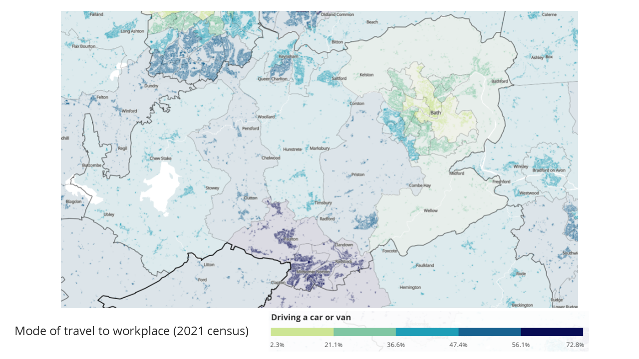
Around 30% of carbon emissions in B&NES currently relate to transport. Since the Covid-19 pandemic, an increasing proportion of people work from home. However, at least some of the time, travelling to work is still an important journey for many, as well as regular journeys to access key services and facilities, such as schools or local convenience shops. The maps below from the 2021 census provide a useful indication of the propensity to travel to work by car (as opposed to more sustainable means), as well as the distances travelled to work. The maps show that a greater proportion of people travel to work by car and travel a greater distance in the more rural parts of the District, and also the Somer Valley.
Figure 5: Extract from 2021 census showing mode of travel to work by car
Figure 6: Extract from census 2021 showing distance travelled to work
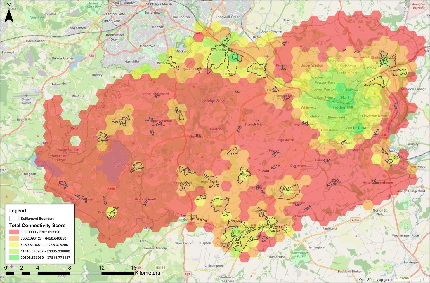
4.6 Analysis has also been undertaken of broader connectivity of different areas across Bath and North East Somerset by sustainable means of transport to a range of important services and facilities, as well as employment areas. The map below provides a useful indication of the relative sustainable transport connectivity, with the areas in green/yellow as the best connected (primarily Bath and the Bath-to-Bristol corridor), moving through oranges (Somer Valley, and some of the larger villages) and then red for the least well connected (most rural areas).
Figure 7: Relative sustainable transport connectivity across B&NES


