4.13 More than two-thirds of B&NES currently lies within the designated Bristol-Bath Green Belt. The Green Belt is designated to keep land permanently open. National policy (NPPF Section 13) outlines the five purposes of the Green Belt, summarised as follows:
- Check the unrestricted sprawl of large built up areas
- Prevent neighbouring towns from merging into one another
- Assist in safeguarding the countryside from encroachment
- Preserve the setting and special character of historic towns
- Assist urban regeneration by encouraging the recycling of derelict and urban land
4.14 The Bristol-Bath Green Belt was originally designated in the 1960s, primarily in order to check the unrestricted sprawl of Bristol and Bath, and to ensure the two cities and surrounding towns do not merge. Land can only be removed from the Green Belt and allocated for development through a Local Plan, and only if ‘exceptional circumstances’ exist. The Green Belt in Bath and North East Somerset has remained largely unchanged, although land has been removed principally on the edge of Bath, Keynsham and Whitchurch for development through the B&NES Local Plan (2007) and Core Strategy (2014).
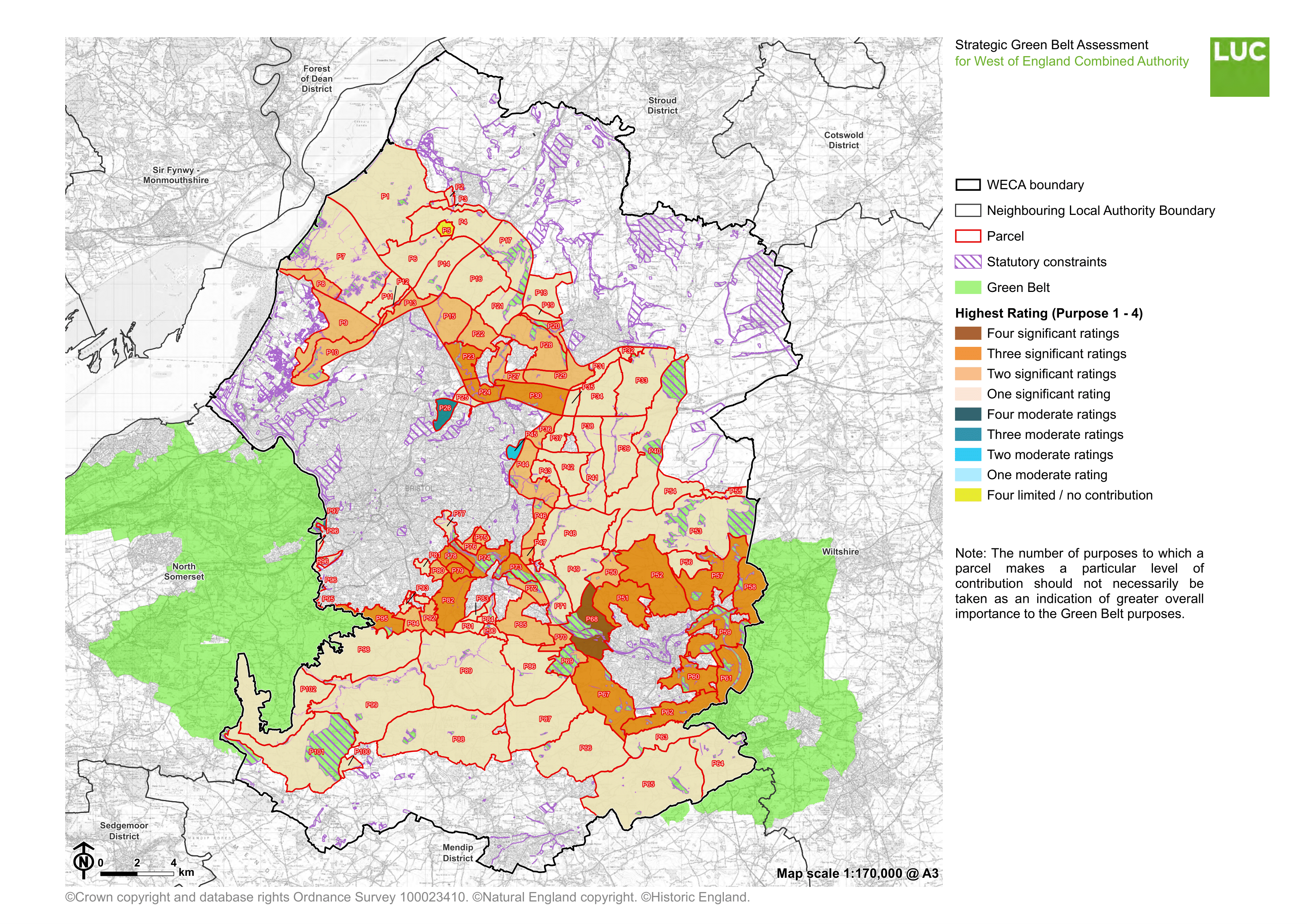
4.15 The Green Belt will be a further important influence on the location of development in the District. Development of land currently within the Green Belt may need to be considered through the Local Plan in order that the evidenced need for further housing and employment development can be met. To understand and consider the impact of potential development on the Green Belt, an assessment of the Green Belt and the purposes served by different areas of land within it will need to be undertaken. An assessment across the West of England has already been undertaken and this will form the basis for more detailed assessment to support the Local Plan. The map below is taken from the West of England Green Belt assessment and illustrates the extent to which different land cells serve the nationally defined purposes of Green Belts. Those areas in darker colour more strongly serve a greater number of the purposes. It should also be noted that, where development requires the removal of land from the Green Belt, measures to improve and enhance the remaining land within the Green Belt will be required. This will be considered in preparing the Draft Local Plan.
Figure 10: Extract from WECA Green Belt Assessment

