A cleaner and quieter local neighbourhood
Reducing the impact of motor traffic
The scheme should change the character of the road at both ends of Copseland. We aim to encourage more people to travel on foot or by bike, resulting in less congestion and better air quality in your neighbourhood.
Improvements for pedestrians should also mean better road safety, improved accessibility for buggies and wheelchair users, and reduced traffic noise.
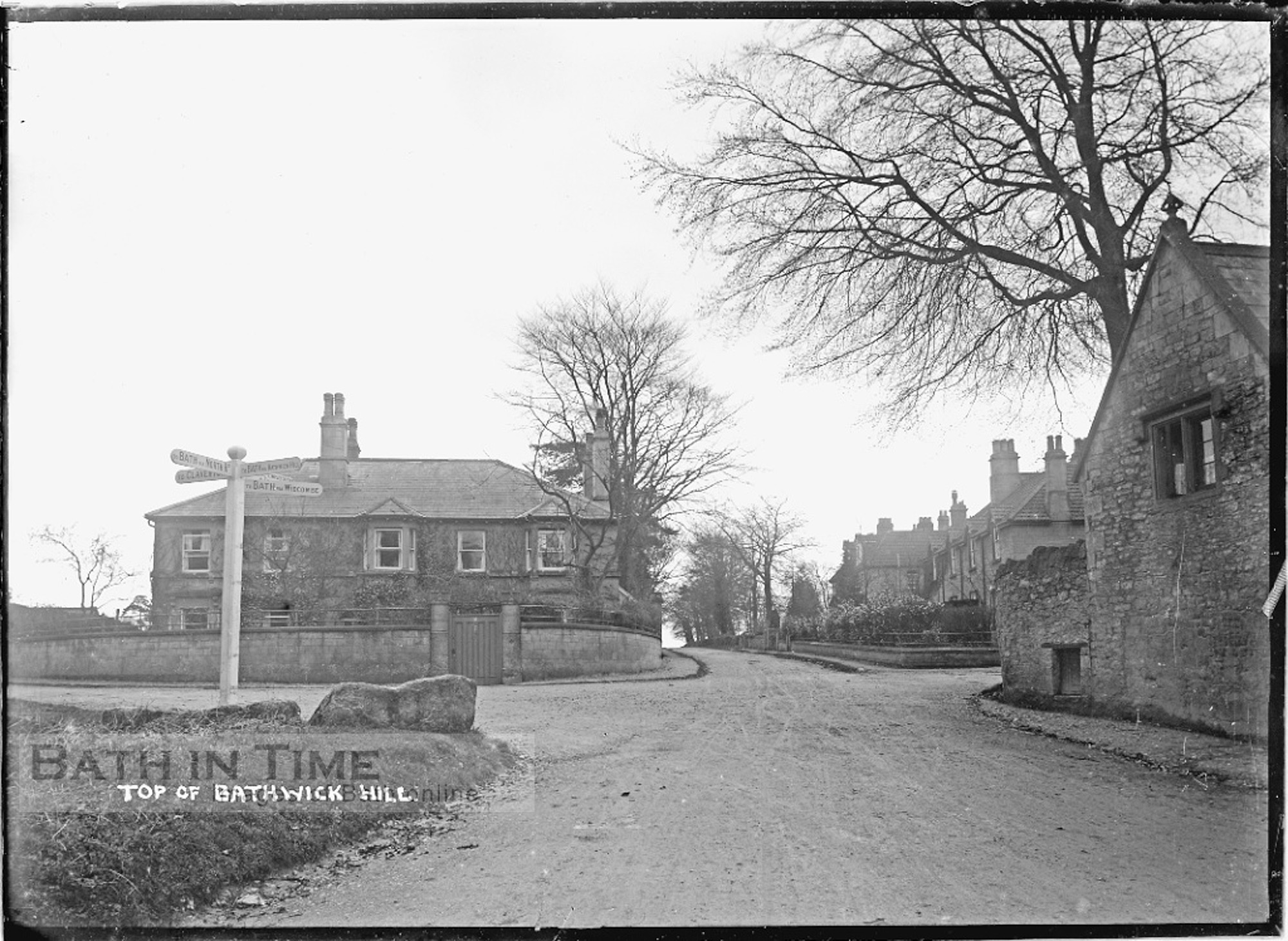
Historic features at the top of Bathwick Hill
Within the shrubs at the top of Bathwick Hill, next to the bus stop, is a historic boundary stone. This historic stone feature is thought to be an original parish boundary marker.
View a historic image of this feature
View a Google image of the site today (stone covered with shrubbery)
To make a safe new crossing at this junction, we will need to move this stone a few metres. (View the scheme drawing, which marks the proposed relocation of the stone with a coloured triangle). The new location for the stone, which has been hidden within the shrubs for many years, would make it visible for everyone. As part of the opening up of this junction to pedestrian and cycle traffic, we also intend to reinstate a traditional fingerpost road sign at this location. This will replicate the sign which used to stand here, and is thought to have been removed at the outset of the Second World War.
View a historic photo of the junction layout and fingerpost road sign
Instructions on how to use our mapping tool
- Google satellite images of the current road layout and markings
- Plan drawings of the changes we are proposing