We are asking for your views on our proposal for a Local Development Order (LDO), and supporting documents, for the Somer Valley Enterprise Zone (SVEZ), a commercial mixed-use development on the edge of Midsomer Norton. Use this page to support you to access the documentation we are submitting, and to understand the context, history and wider aims of the project.
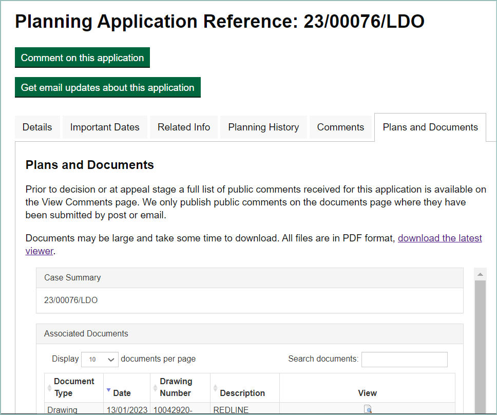
The process of applying for an LDO takes place via our local Planning Register, and you can comment on the proposal and associated documents, like any other planning application.The LDO is now on the B&NES Planning Register, with a reference number of 23/0076/LDO.
Find out more about LDOs, and why they are used
LDOs are used by Local Planning Authorities to help set the planning framework for an area and to bring forward development. They provide 'permitted development rights' for specified types of development in defined locations. They are essentially a type of planning policy ‘zoning’, which grants planning permission for specific development proposals, or classes of development, within a defined area.
How an LDO works
LDOs are flexible tools which cover a range of uses, scales of projects, and size of buildings. LDOs streamline the planning process, by removing the need for developers to make a planning application to a Local Planning Authority (LPA).
The SVEZ LDO will include a design code, setting out what buildings and spaces should look like in the final development, and how they should function.
The purpose of an LDO
LDOs can accommodate changes in market conditions and accelerate the delivery of development.
Creating an LDO for a large-scale development provides more certainty about the progress of the project. Investment becomes more attractive, because the LDO simplifies the planning process, making it easier to deliver the project on time and in budget. Creating an LDO for the SVEZ project will help provide greater flexibility for potential developers, and greater certainty for local people. This allows development to come forward more quickly and with greater ease.
How an LDO is implemented
Once an application for an LDO is submitted, there is a formal public consultation process (this process), which must run for at least 28 days. This allows for local input, guiding development in the right direction, in terms of demand and local aspirations.
Read more about LDOs, where and why they already exist in England
Project context, and progress so far
This is the first statutory consultation on this project, and follows on from an informal public engagement in May and June 2022. To find out more about the project in context, including how we have updated our plans based on feedback from that engagement process, please see the Somer Valley Enterprise Zone: Project overview webpages.
What we are consulting on
Our planning application consists of a Local Development Order document, and a large number of supporting documents. Select any document and use the guidance below, to help you to decide which documents you wish to read and comment on.
How to view the LDO documentation
The documents list will help you to get a clearer idea of the proposals that form the LDO, and the evidence we are using to base them on. These documents form the supporting reports that are being consulted on by the Local Planning Authority. Select any document title in the list below, to read in more detail about its function, what it contains, and how the information is represented in the documents list on the planning application itself.
Most documents are split into sections, and many have appendices, so you may need to view several entries to get the information you need. Use the document list below to guide you on how many documents, or parts, you will need to find.
Finding the documents on the LDO planning application
You can only view the plans, drawings and reports submitted with a planning application by visiting the entry on our online Planning Register. Select the Plans and Documents tab on the right of the data dashboard and scroll down the list of Associated Documents below, to view or download the document you need.

The development we are proposing, and how we plan to progress
These are core documents which outline in principle what we expect the development to look like, and to achieve. They include what we expect the LDO to cover, and why, and how we are consulting people who may be affected by the development.
Local Development Order
This document provides permitted development rights, for specified types of development, in defined locations. This document provides the following core features:
- A description of the development which the order will permit
- An Illustrative Masterplan, identifying the land to which the order will relate
- Relevant planning policy considerations and rationale
All of the following documents form part of the core information about the LDO:
- Local Development Order and Statement of Reasons
- Illustrative Masterplan and Masterplan Fixes
- Site Location and 3 Red Line Boundaries plans
- Site Sheet Plan, and 6 subsheets, showing the general arrangement of the site
- Plot Boundaries and Land Use Plans
- Strategic Landscape Plan
- Building Heights Plan
- Project Phasing Plan
Design Code
Design and Access Statement
Statement of Community Involvement
Technical studies and assessments
These are expert reports on various aspects of the site, development and works to the highways network, which aim to measure impacts of the scheme. Typically, they cover both the period of construction, and once the development is completed. They lay out any concerns that will need to be taken into consideration, and how it is planned to address or minimise them
The Air Quality Assessment and Noise Assessment will be available to view and comment from Monday 23 January.
Ecology Report
Ecology-Habitat Management Report
Landscape Visual Impact Assessment Main Report
- LVIA Assessment
- 7 part LVIA appendices, mostly showing viewpoints of the site
- Strategic Landscape Plan
- Building Heights Plan
Heritage Assessment
Transport Assessment
- Framework Travel Plan
- 4 Part plans, diagrams and appendices
- Road Layout Plan
- 12 Transport Assessment Appendices (showing various road plans and proposed highway changes, both inside and near the development site; some appendices duplicate information contained in the 4 part plan documents)
Lighting Strategy
Sustainability Statement
Flood Risk Assessment
Drainage Strategy
Noise Assessment
Air Quality Assessment
Environmental Impact Assessment Screening and B&NES Council Response
Take part in the consultation
The consultation is open from Monday 16 January 2022 and will close at 5pm on Monday 13 February 2023.
All of the information you need is on our Planning Applications portal, reference 23/00076/LDO
You can use this tool to do all of the following:
- View all of the documents
- Tell us if you support or object to the application
- Leave your own comments
- Read other people's comments
What happens next
All comments made on a planning application are part of a statutory public process, and will remain available to view by the public, even after the Planning Application process is complete.
When the consultation closes, we will review and analyse all the responses. We will consider your feedback, and will include it in the final version of the Statement of Community Involvement. The Local Planning Authority will review the LDO and comments, and the Council Cabinet will then make a final decision on whether to approve the LDO.
