Please enable JavaScript in your browser to use this page.

Bath Quays links consultation

View the consultation proposals

The Bath Quays Links project includes improvements on the A367 Green Park Road and A36 Lower Bristol Road. Use this page to see the proposed changes on a map.

There are several maps for both areas to detail our proposals from west to east. 

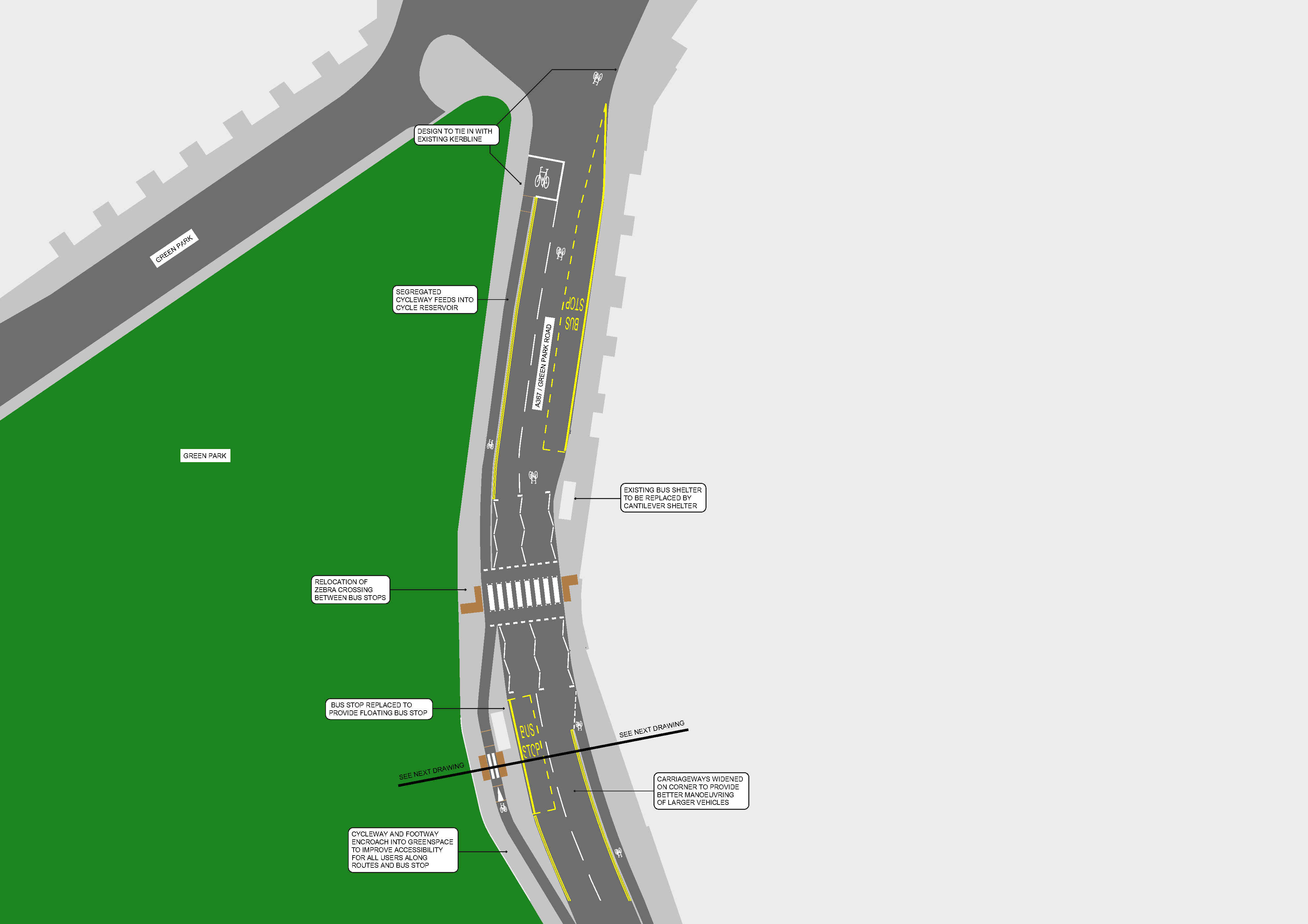
Green Park Road

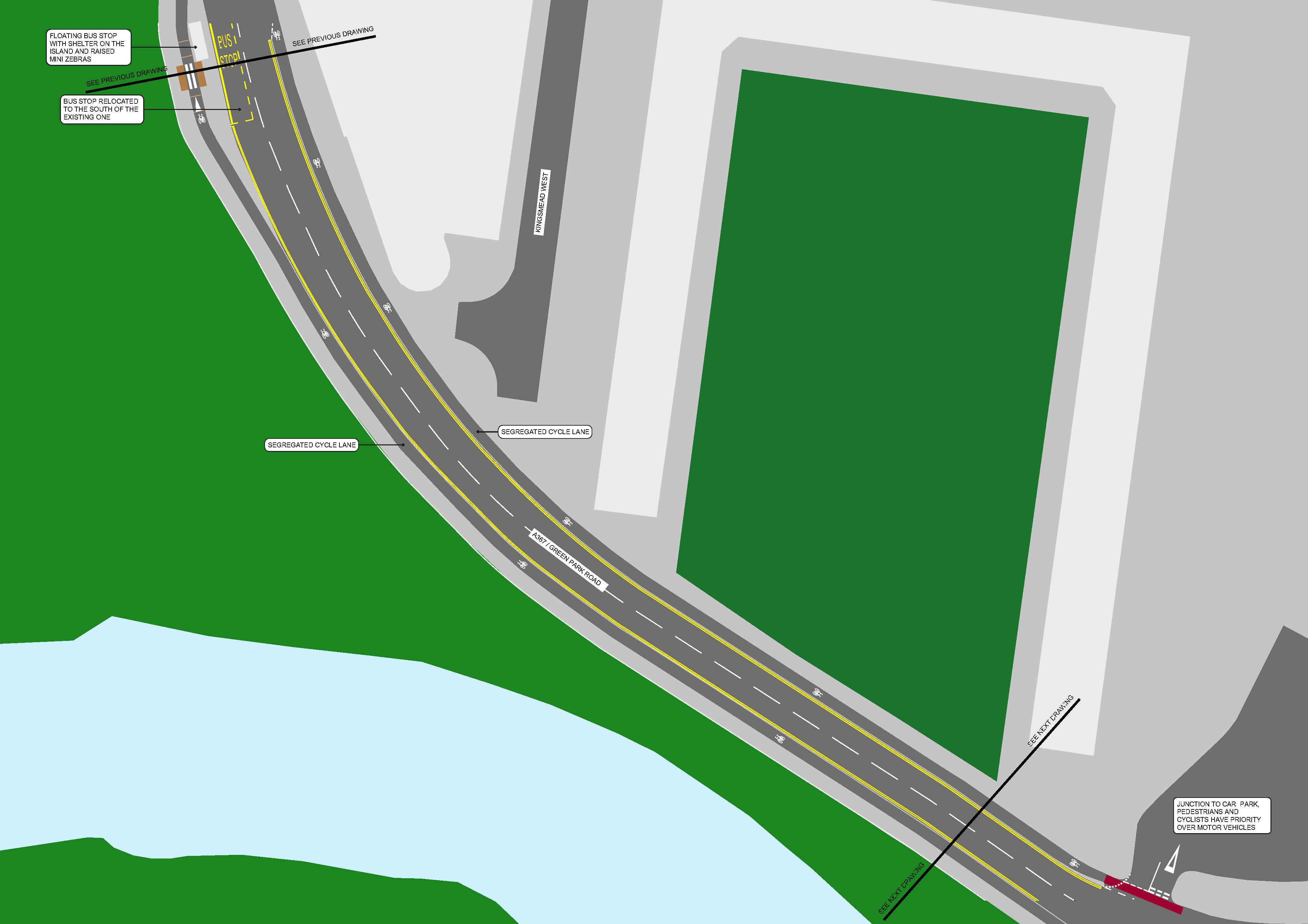
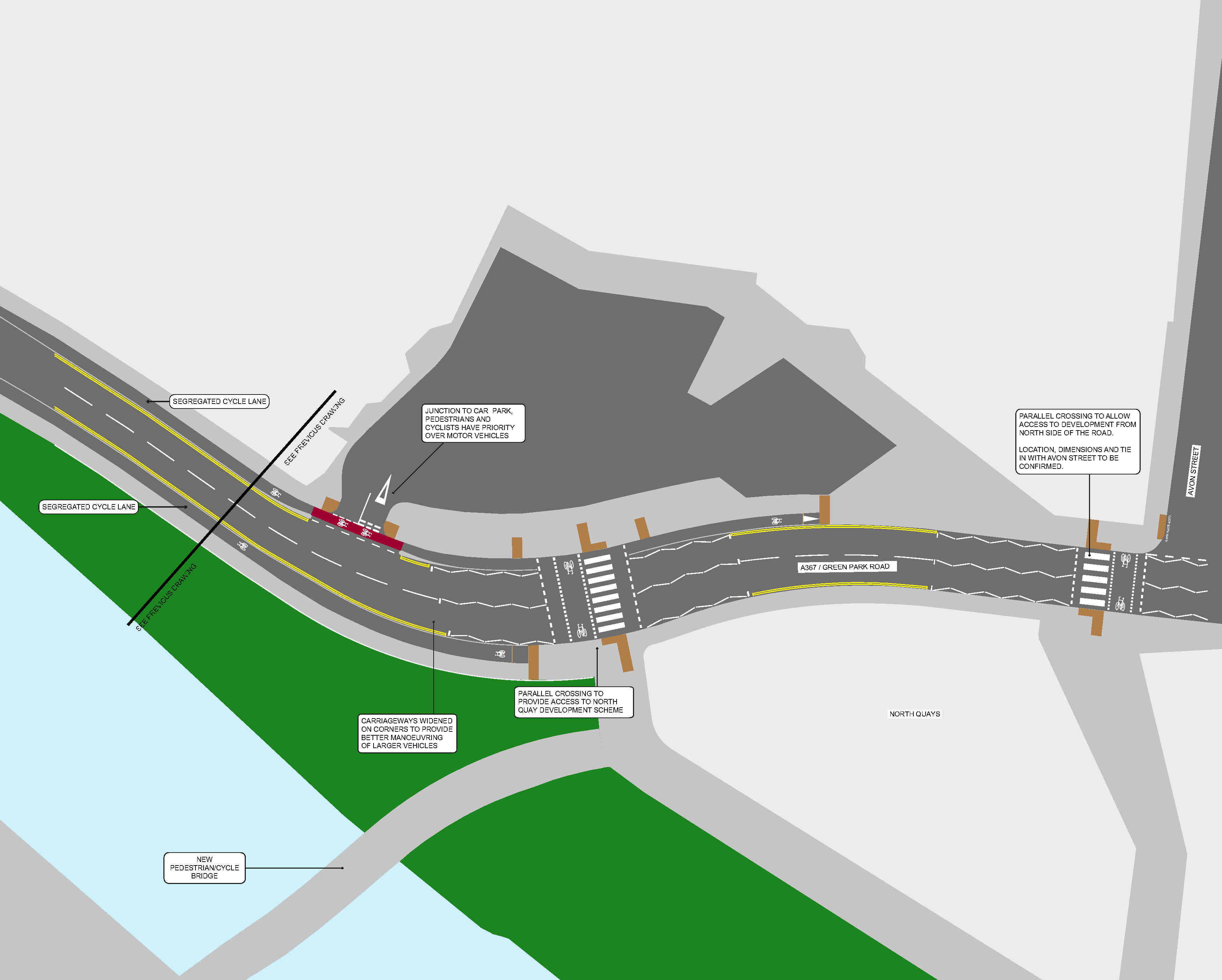
The following maps show the proposed improvements to Green Park Road, from west to aast. Click any map to enlarge.

Map of section 1 of the proposed improvements to Green Park Road as part of the Bath Quays Links project.

Open a large version of Green Park Road, section 1

Map of section 2 of the proposed improvements to Green Park Road as part of the Bath Quays Links project.

Open a large version of Green Park Road, section 2

Map of section 1 of the proposed improvements to Green Park Road as part of the Bath Quays Links project.

Open a large version of Green Park Road, section 3

Lower Bristol Road

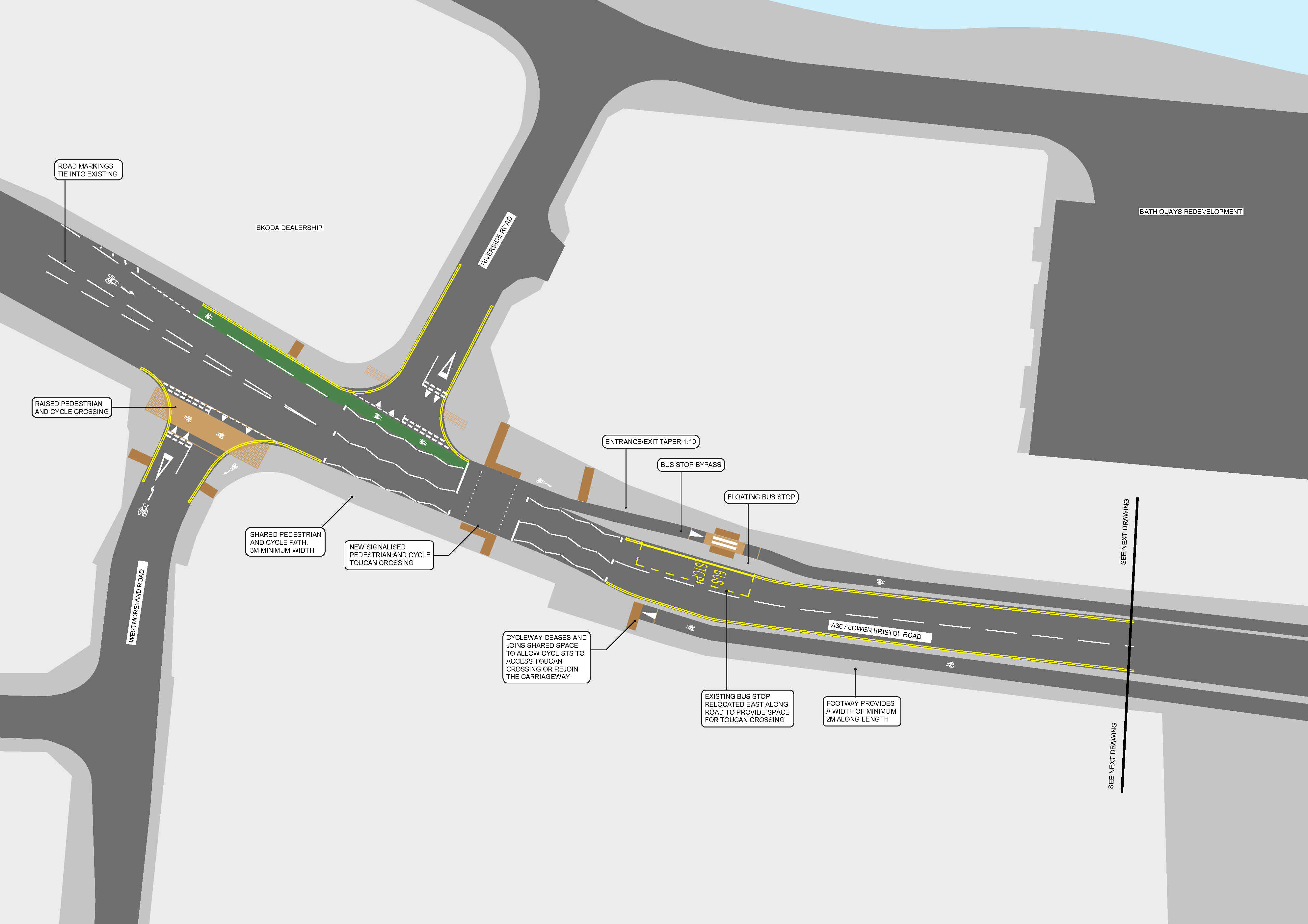
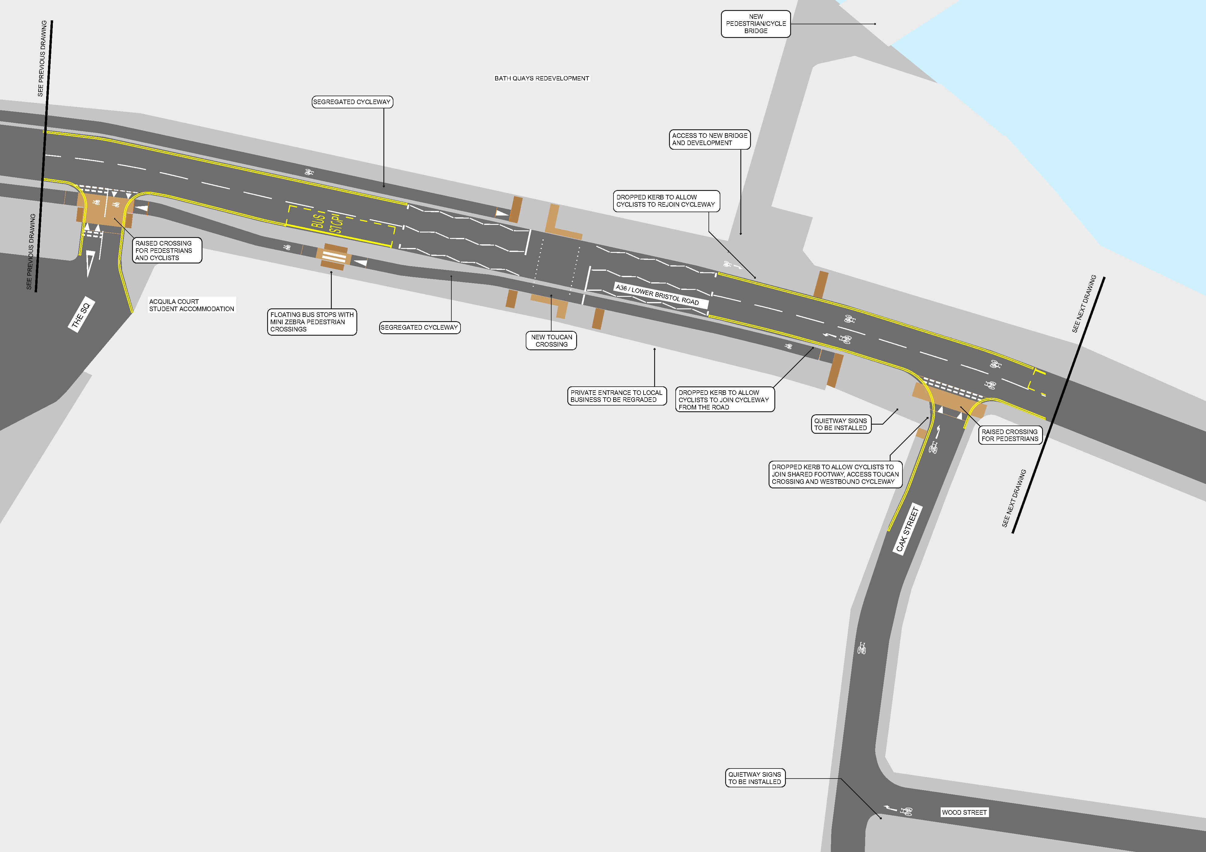
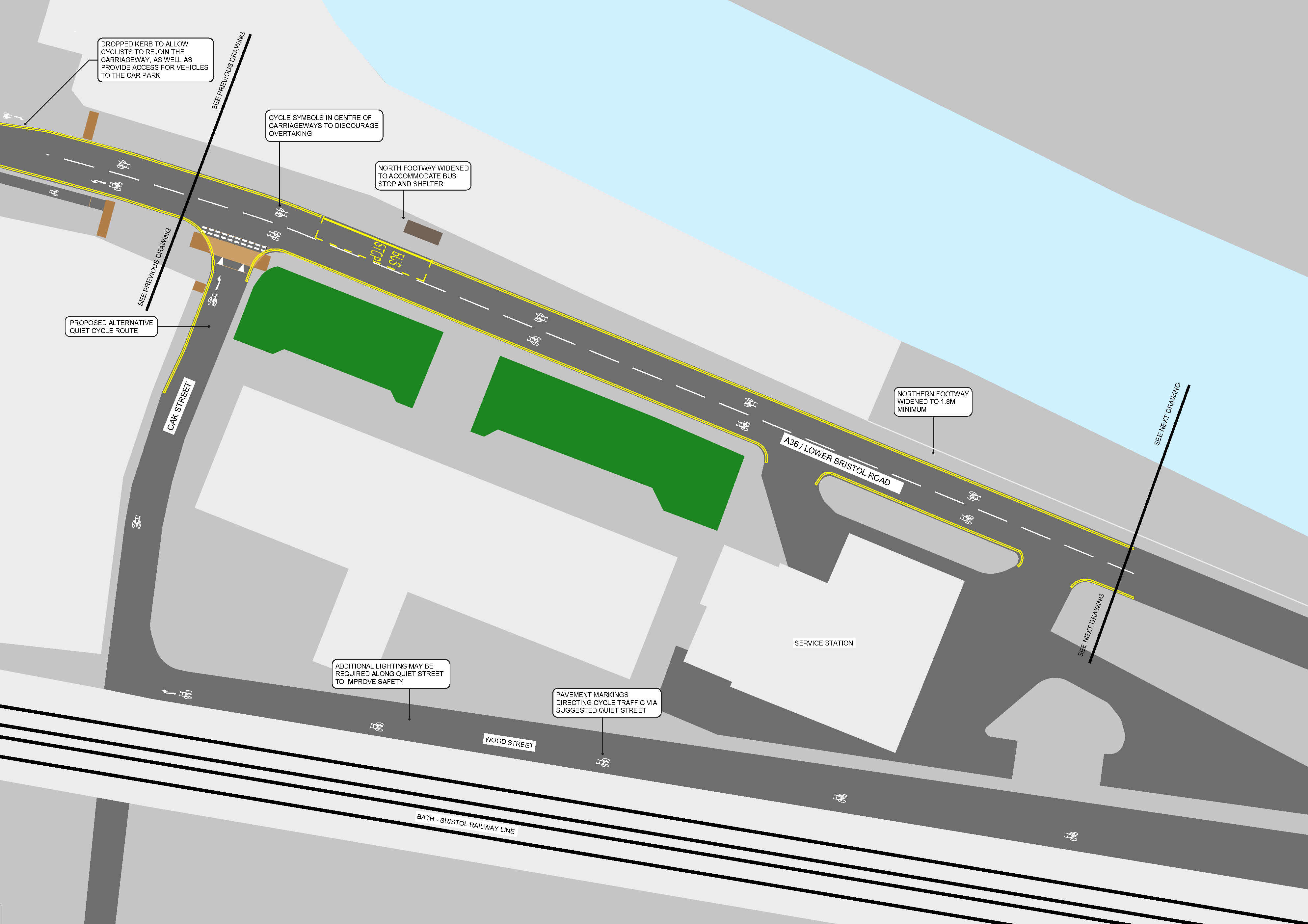
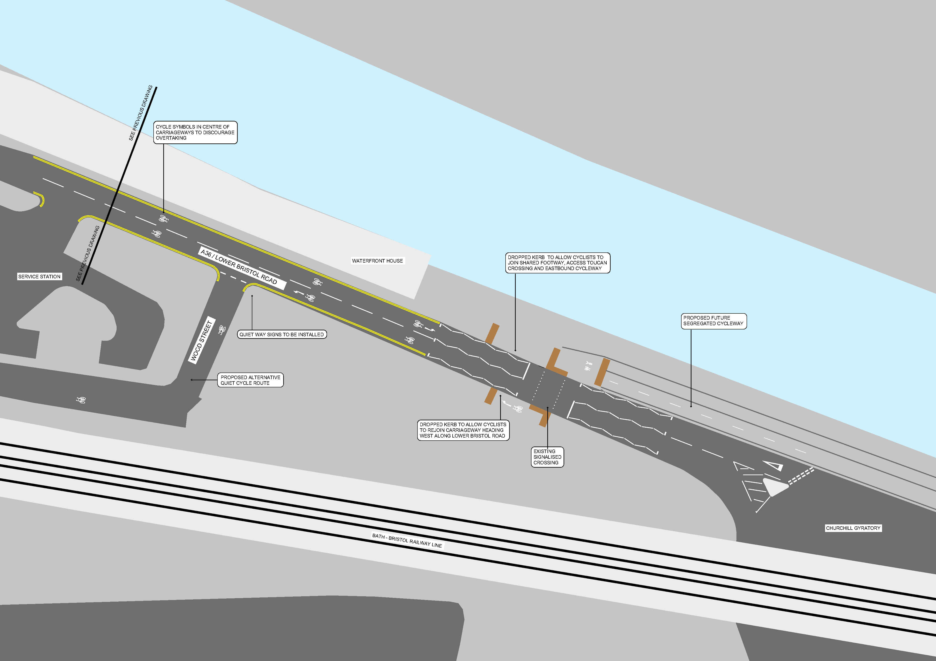
The following maps show the proposed improvements to Lower Bristol Road, from west to east. Click any map to enlarge.
Map of section 1 of the proposed improvements to Lower Bristol Road as part of the Bath Quays Links project.

Open a large version of Lower Bristol Road, section 1

Map of section 2 of the proposed improvements to Lower Bristol Road as part of the Bath Quays Links project.

Open a large version of Lower Bristol Road, section 2

Map of section 3 of the proposed improvements to Lower Bristol Road as part of the Bath Quays Links project.

Open a large version of Lower Bristol Road, section 3

Map of section 4 of the proposed improvements to Lower Bristol Road as part of the Bath Quays Links project.

Open a large version of Lower Bristol Road, section 4